Anthony Guay
Remote Sensing Specialist
260 Nutting Hall
University of Maine
Orono, ME 04469
Phone: 207-581-2962 Fax: 207-581-2875
anthony.p.guay@maine.edu
- M.S. University of Maine (1997)
- B.S. University of Maine (1994)
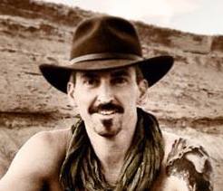
Tony Guay is a Remote Sensing Specialist with the Wheatland Geospatial Lab. Tony provides remote sensing and geospatial training to stakeholders in Maine’s forest sector, including industry professionals, small woodland owners, and conservation partners. He supports geospatial science teaching and research efforts in SFR and is responsible for outreach and coordination with various stakeholders throughout the state. Tony is a founding member of the Maine Geospatial Institute (MGI) and serves on its Executive Committee. MGI is a statewide collaboration across the University of Maine System for workforce development, education, and research in geospatial science.
Prior to his appointment at UMaine, Tony was an analyst and instructor with RedCastle Resources, Inc., working onsite at the US Forest Service – Remote Sensing Applications Center in Salt Lake City, Utah. During his 18-year tenure at RSAC, Tony was responsible for the coordination, implementation, and management of a national post-fire vegetation severity mapping program. He was also a lead instructor for the training program at RSAC, providing courses and workshops to Forest Service personnel nationwide on a variety of remote sensing and geospatial topics.
Learn more about our teaching, research, and outreach resources at the Wheatland Geospatial Laboratory at https://umaine.edu/wheatland-lab.

